 Here is on interesting piece of trivia about Beaver Creek Valley State Park. Since is it in a valley and pretty much in the middle of no where you can't get any cell service at all. This is actually a really rare experience and not one that I was prepared for. I don't mean this in the way that you are probably thinking, I have no problem surviving without cell phone coverage but I didn't load the geocache in the GPS in advance ( you don't actually have to be on the internet to use the ap) so I didn't have the coordinates to start the geocache. We learned that you had to drive a bit out of the park to get it back. The good news is that this park has GPS's that you can borrow, the good old yellow Garmin GPS, that we were already familiar with.
 Once we got the GPS we went to the ranger station where the first set of coordinates (right on the kiosk), super easy to find. It had kind of been drizzling all morning so we were hoping to do this find quickly and get on our way to the next stop. So we all hopped back in the car and tried to figure out where our next stop was.
We got to a point on the road where it looked like were pretty close so we jumped out of the car and headed towards the direction the GPS pointed. We walked down a small trail and ended up at the creek. The GPS still said it was 400 more feet away.
And it was pointing right across the creek (there was no bridge) and we couldn't see any trails that would bring us that direction.
So we looked at the map and identified a trail that looked like it went right about were this was. The bad news is that there wasn't an entrance to it close and it did look like it was going to be a bit of a walk. I admit, I was a tad bit whiny on this Monday morning (it was sprinkling and seriously annoying me) but we really wanted to get this done.
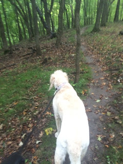
We started the hike- I don't have a lot of pictures but believe me when I say it involved a LOT of uphill hiking, we brought not only Marcus with, but Sandy too! At one point we had to walk across a bridge over a small ravine. Wouldn't have been an issue at all, except for the fact that a tree fell on it, making our passage much more difficult. Sandy did great but he pretty much had to duck and crawl to get under, it was pretty interesting trying to explain this to Sandy!
The hike was pretty and the tress were beautiful but then it started to rain!
Fortunately by now we were at the top of the hill and very close to the Geocache, which Marcus found (with just a little nudging).
Right about this time it really started raining so Luke and I made a few decisions- He was going to head back down the trail we just came up to go back to the car. Marcus, Sandy and I were going to continue down the trail the other way back to the rangers station. According to the map that looked like a far easier trail. So off we all went!
Did I forget to mention that I was wearing the WRONG shoes to go hiking. Had I realized how hard this one was, I never would have worn these sandals. To make things even yuckier they completely filled up with mud and got really slippery!
We started walking back down, and the rain started to picking up. We were all getting really wet.
Marcus said he was cold so I gave him my vest, next he said he was getting wet to he got my hat too.
I think he just looked like a little "tiny tim" It was so cute!
But at last we made it back safely and found Luke who was already waiting for us. What a great and rainy adventure!


I kept my old phone. I load coordinates when I have a WiFi connection. As you so correctly noted GPS functions without a data plan. It saves both data usage and battery run time.
ReplyDelete