Grand Portage State Park
—Grand Portage, MN—

 Grand Portage State Park sits at the board of the United States and Canada. You can actually clearly see the boarder crossing right from the parking lot of the state park. This park looks incredibly unassuming from the front (it actually just looks like a roadside rest stop), but it actually is far more than that. Although I have driven by it before, I have never stopped, so this was a park that I was really looking forward to seeing. "Torrents of wild water plummet 120 feet over the High Falls down to the Pigeon River in this park on the U.S. - Canadian border. The falls, the highest in the state, presented a serious obstacle to river travel, so a 'carrying place,' or portage, was necessary. American Indians created the ancient nine-mile trail from Lake Superior to bypass the falls. This trail became known as 'The Grand Portage.' Today, visitors of all abilities can take a one-half mile trail and boardwalk to the falls overlook area. The park is designed for day use only and contains mixed hardwood-conifer forests and hiking trails along the banks of the Pigeon River. The spectacular scenery sets the stage for recreational opportunities that include hiking, photography, and picnicking."
—Minnesota DNR website

  |
| Marcus checking out the visitors center. |
We started our geocaching travel today just north of Duluth (we drove all the way from Decorah, IA two days ago straight through La Crosse, WI and Eau Claire, WI to get to Duluth to see Luke's family) – but that is still a far way from Grand Portage (160 miles along Highway 61 on the Lake Superior North Shore). The drive up was pretty slow because of a couple of one-lane construction spots, and Marcus actually was awake for the entire drive. When we got to the stop he was very happy to get out of the car and run.
 |
| Parking lot |
Behind the visitors center is where all of the trails run. We could tell by looking at the GPS that we needed to head that way to find our first location. The trail was really nice and paved and huge. It was also wheelchair- and stroller-accessible (that always makes things a bit easier).

There were some really nice views of the Pigeon River (that separates the U.S. and Canada) on the hike. It was pretty still and serene when we started hiking.


Marcus started the day out in the stroller and enjoyed taking it for a ride. He got to see all of the nature around us. This was the dense northern woods, much more so than all of our other state parks so far.

It didn't take long to find our first location on the journey. It was hidden right under the sign for the Middle Falls Trail. This is actually a new trail to the park that was just completed earlier this year.

Unlike the trail to the the Big Falls this trail was not as "friendly"; that is, you can see me pushing over the dirt trail and the occasional board bridge. This was a bit more strenuous of a hike, but it was fun going right through the woods. If you read the above sign on trail it is rated as "difficult" and had lots of steps. We were really hoping to find our cache before we hit them, or one of us would have to turn back.


We even got to climb over a downed tree in the middle of the trail – if you notice we don't have our off-road stroller on this trip, so this also made life a bit more difficult.

Fortunately, it was not long until we found our next stop, and it was the final location.


 |
| Marcus waiting anxiously for his "bock bock"- when he sees the box he already knows it is coming. |

Once we found the box we turned back onto the trail and decided that since we drove all this way we wanted to go see the high falls. If there was one park we wanted to spend a bit more time at it was Grand Portage. So we turned back up the nice, stroller-accessible trail.

It wasn't that far and we made it to some stairs – we could hear water running in the distance, so we knew that we were close to the falls.


When we made it to the top of the stairs, we were treated to a pretty awesome view of Pigeon Falls. Guess I can see why the voyageurs wanted to portage around them (and quite a long ways too: 8.5 miles of portaging – grand, indeed!). They are the highest waterfalls in Minnesota. Canada is actually on the other side of the river (see the picture below). Grand Portage, MN is also home to one of the two national monuments in the state (the other being Pipestone National Monument in SW Minnesota, where we would be going near on our next long trip).
 |
| The 120-foot High Falls at Grand Portage. Canada on the other side. A rainbow in the foreground. Water droplets everywhere in the air. Very cool. |

I was hanging on to Marcus pretty tight....Both hands were wrapped around him so he could not escape while on the overlook (it was pretty steep when you looked down, although there were guardrails everywhere).
 |
| Vonnie and Marcus with the Pigeon River and Lake Superior in the background. |
 |
| At the High Falls lookout. |
 |
| "Look down there, Marcus!" |
This is a pretty rare sighting of the three of us in a picture, but this is a really awesome place.

Another view of the falls.

We came and saw the falls (veni, vidi, vici, eh?) now it was time to go on to more parks and more geocaches. We will come here again.
 |
| Tons of walkways and stairs at this park. |

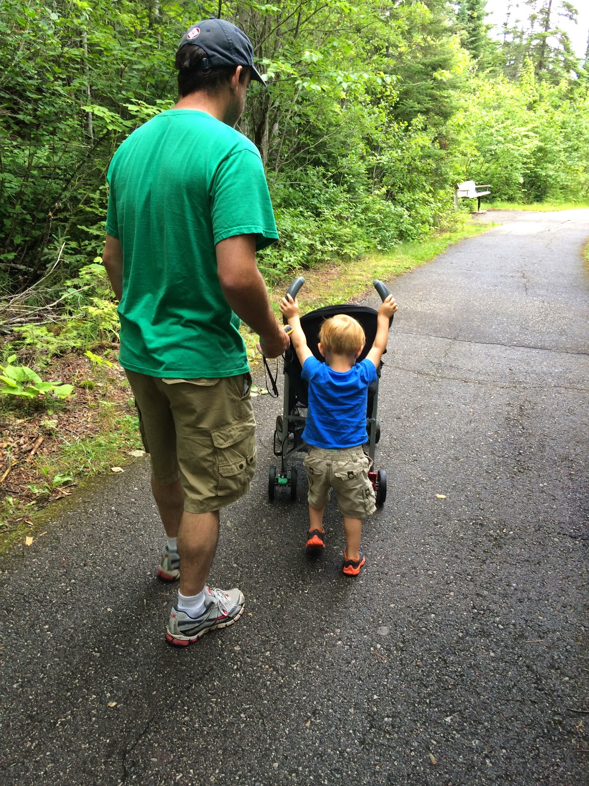
At some point on the way back Marcus decided that he wanted to push the stroller... that slowed us down quite a bit. He is so independent these days!

Our first "bock bock" card of the day.


Marcus is ready to go to the next stop.

No comments:
Post a Comment