George H. Crosby Manitou State Park
—Finland, MN—

By the time we left Temperance River State Park we knew that we were racing against the clock. The odds of hitting and getting all eight of the north shore state park geocaches completed were diminishing by the minute, but since we were working from the farthest north point (Grand Portage State Park) and going southward, we were at least saving future mileage. We were not helped by the the road construction on Highway 61 – there were two sections that actually required a pilot car to get through the road construction, and so we had to wait at a stop each time.

 George H. Crosby Manitou State Park (GHCM State Park) is one of those parks that I had never been to before – despite the fact it is close to Highway 61 it is not as conveniently located as the other North Shore state parks. In order to get there you have to head inland from Highway 61 up to the town of Finland, MN. Next, we turned down a small gravel road and drove for about 6 miles along the river. This was a pretty long road, and we did not have any company on it. On one side of the road you can see a murky, slow river winding down the gently-sloping topography. It felt like we were driving into the middle of nowhere. According to the DNR website this state park site is intentionally really remote. To wit: "The park was a donation from George H. Crosby, a mining magnate who had been involved in the development of both the Mesabi and Cuyuna iron ranges. The state eagerly accepted the gift of this 3,320-acre tract on the Manitou River and formally established it as a state park in 1955. From the beginning, the decision was made to limit development of this park. Instead of the customary campground, the park has primitive campsites scattered through the park, accessible only by foot trail. George Crosby Manitou State Park was the first park in the system to be designed primarily for backpackers and remains a backpack-only park." —Minnesota DNR website
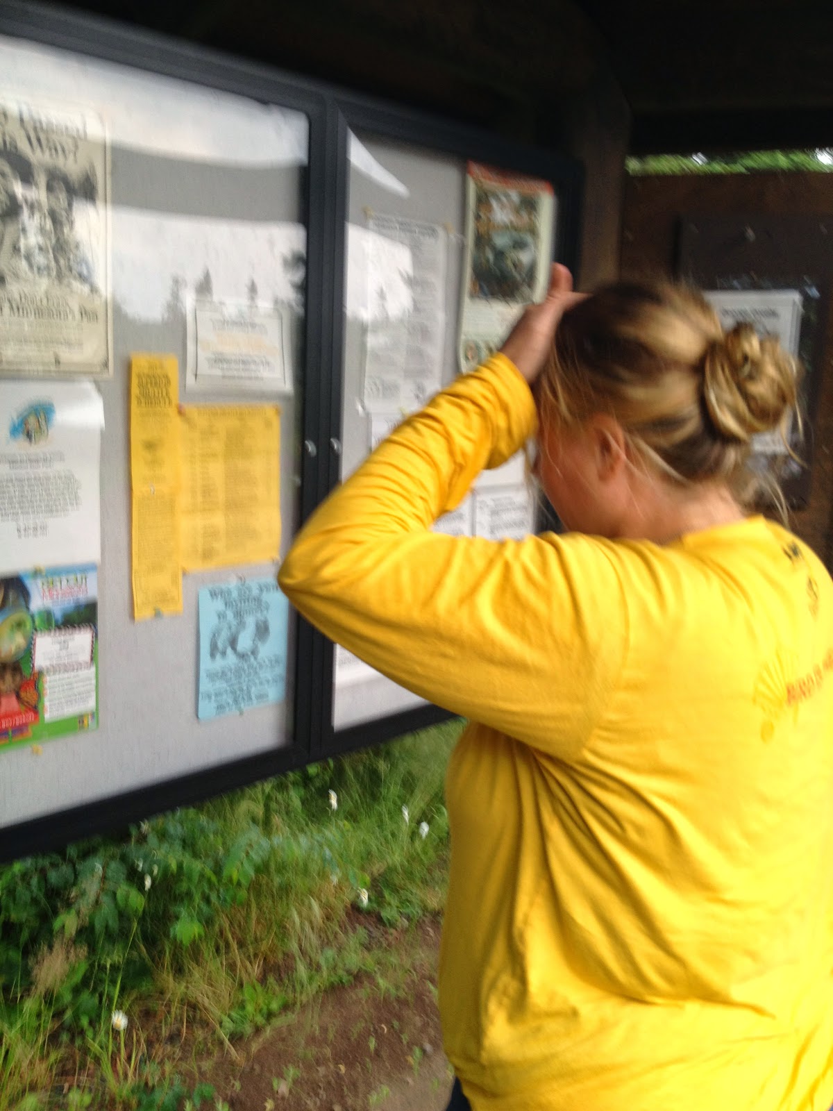
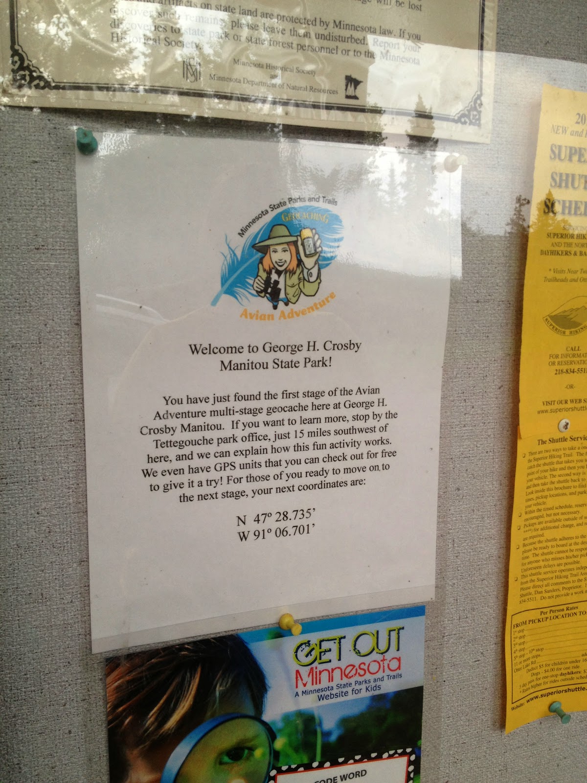
Eventually we got to the welcome sign and a kiosk. This is an unmanned state park, so there was no ranger station nor were there any rangers around. The coordinates to the next location were located right on the sign shown below.


 |
| This is a map of the park. The red line on the bottom right corner is Highway 61. This park is pretty big, but you would never know it if you just saw it from down on the highway. The Manitou River flows through the state park on its path to Lake Superior. Very pretty scenery. |


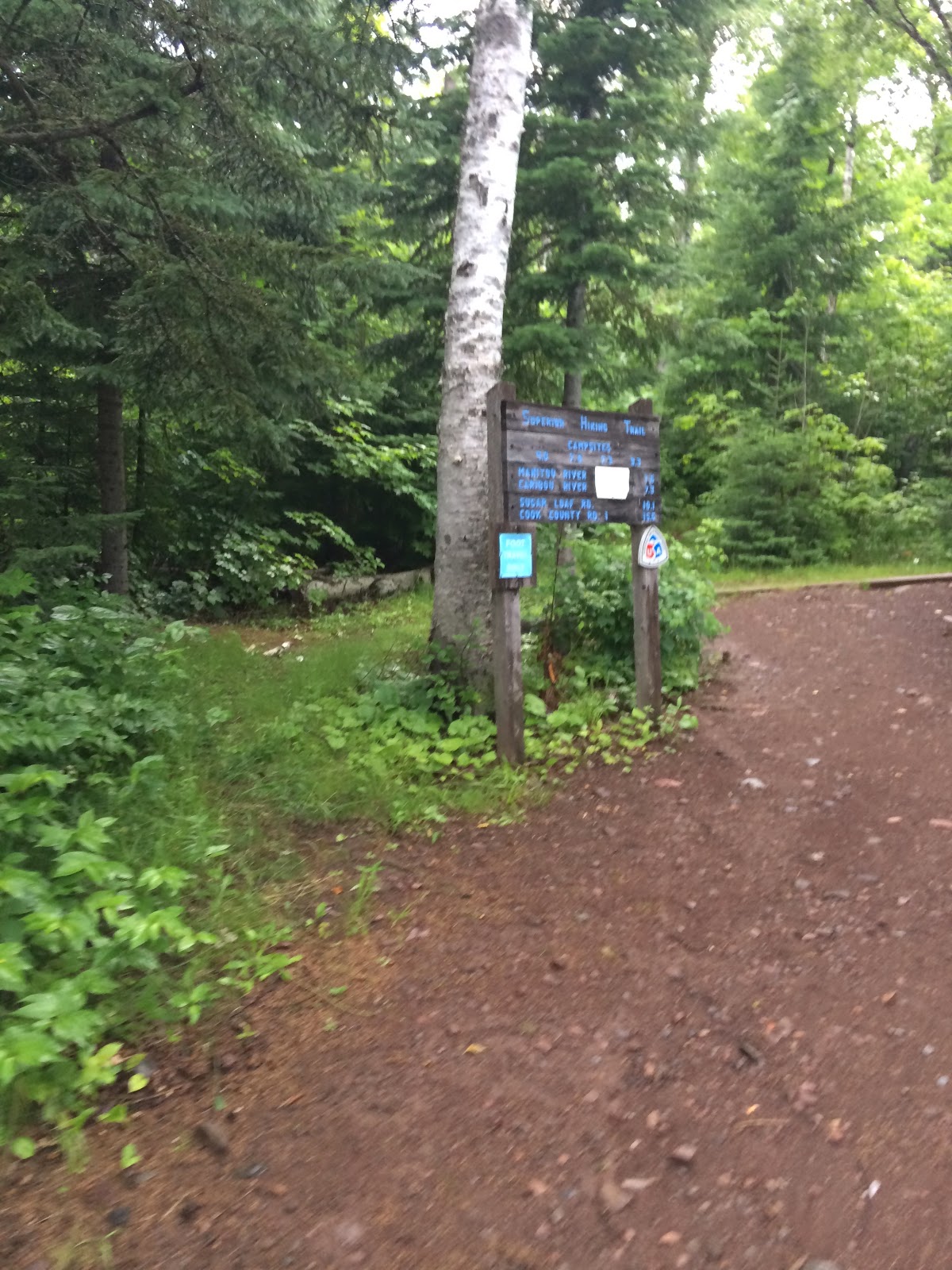
The second set of coordinates appeared to be farther down the road by a parking lot, so we jumped back into the car to find the next sign. We drove the road and found the parking lot – it turns out that we were not the only people in the park. I am guessing that these people either were hiking or maybe they were camping at one of the backpack camping spots that you hike in to get to.
We saw a sign and, even from our parking spot, could see the next set of coordinates.
Just a piece of trivia – did you notice I am wearing different clothes than the last state park (Temperance River State Park)... that is because I had to change from the ones that got soaked in the rain earlier in the day.


Marcus had fallen asleep on this part of the drive and was still sleeping when we parked. As this looked like a pretty overgrown spot, I got nominated to attack this geocache. Luke and Marcus hung out in the car.
 |
| The good ole Superior Hiking Trail yet again! |
I headed down the trail. Since we were on the top of the hill (upstream), the entire path was downhill (and, of course, the return path would be uphill).


I tend to keep a pretty minimalist approach to footwear and frequently hike in shoes – normally my Tevas or Birks. This has some positives and negatives:
Positives: lightweight and I don't have to worry about getting wet shoes
Negatives: have to be a lot more cautious about where I step, so I don't stub a toe or wander into poison ivy. Also, my feet can get pretty dirty! As a girl scout this is not approved footwear for hiking, but I do always keep a pair of boots and running shoes in the car just in case I need more cover.
The path was very pretty, but a bit overgrown and slippery from the rain. The trees created cover, so I was completely dry while hiking, so with the exception of the occasional drip, I stayed dry. I moved quickly along the trail, but I had to be careful to not wipe out on the slick rocks—I would have been pretty embarrassed if I had to call Luke to come find me!


About 1/3 of a mile down the path I found a sign that directed me onward.


The path continued downward... actually the slope was becoming a bit steeper. I also started seeing some of the small streams that ran down the hillside.


My GPS was starting to show that I was really close, and I saw a large fallen tree that was really beautiful—tucked inside was the final cache.


 |
| Another "chick-a-dee." |
Knowing that the clock was ticking and the sun would be setting soon, I grabbed the cards and packed up the ammo box. I hurried back up the trail – it was over a half mile uphill – because I really wanted to get at least one more park in.
GHCM State Park was pretty neat. I would like to come back sometime, but I don't think that it will actually make the short list for the near future. Here are the DNR comments on this park:
"Come to this north-country wilderness park where waterfalls cascade through a volcanic canyon surrounded by majestic forest. The trails in the park are carved through a forest of fir, cedar, spruce, and northern hardwoods. Although the trails are steep and challenging for hikers and backpackers, they offer spectacular views."
I got to the car, and we headed out to Tettegouche State Park.
 |
| Getting darker out, but the skies are holding for now. |
On the way to and from the state park we went through Finland, MN, a really cool up north small town back from the Lake Superior shore.
No comments:
Post a Comment