— Old Mill State Park —
Argyle, MN

We got to Old Mill State Park around 7:30 pm, so we knew we did not have a lot of time to play. One thing that was awesome about this trip is that we were actually camping on one of the longest days of the year. This gave us the additional hours we needed to see everything.
Old Mill State Park is one of the two that are located in the Tallgrass Aspen Biome of Minnesota. From the MN DNR Website:
"The Tallgrass Aspen Parklands TAP Province covers a small part (about 3 million acres [1.2 million hectares]) of northwestern Minnesota and extends northwestward into Manitoba, Saskatchewan, and Alberta where it is recognized as the Boreal Plains Ecozone. In Minnesota, the province forms a transition, or ecotone, between semi-arid landscapes historically covered by prairie and semi-humid mixed conifer-deciduous forests to the east. The TAP Province is cold and dry. Mean annual precipitation is about 20 inches to 22 inches (51cm to 56cm), with a small proportion coming as snow. Evapotranspiration is greater than precipitation across the province in Minnesota, with deficits ranging from -6 inches (-15cm) in the western edge to -2 inches (-5cm) in the east. Low precipitation, little spring infiltration, and desiccating winds from the Great Plains promote frequent spring fires and severe stress on shrubs and trees, resulting in a landscape dominated by prairie and open, fire-dependent woodland communities. Extreme minimum temperatures are -40°F to -45°F (-40°C to -43°C) or colder, which exceeds the physiological tolerances of some woody species. The land surface of the TAP Province is composed of features that were shaped by glacial ice and by inundation from Glacial Lake Agassiz."
As a result of being in this biome, this park looked different than all of the other places we have been. It was amazingly beautiful; however, it was marred by the worst mosquitoes EVER and lots of POISON IVY.
We drove up to the office, and it was already closed for the day. So Luke jumped out and grabbed our trusty map, and we were off to the first location which was a way down the road.


In additional to being a state park, Old Mill also has a historic site where the (you guessed it) Old Mill is. We took some time to check that out as well.


Once we got to the parking lot, we quickly found our first location on the information kiosk.


 |
| Vonnie entering the next location into the GPS |
This was a wonderful park – just check out the view from the parking lot – but the second we stepped out of the car the mosquitoes started biting.


It seemed very deserted in parts. Probably due to the mosquitoes.
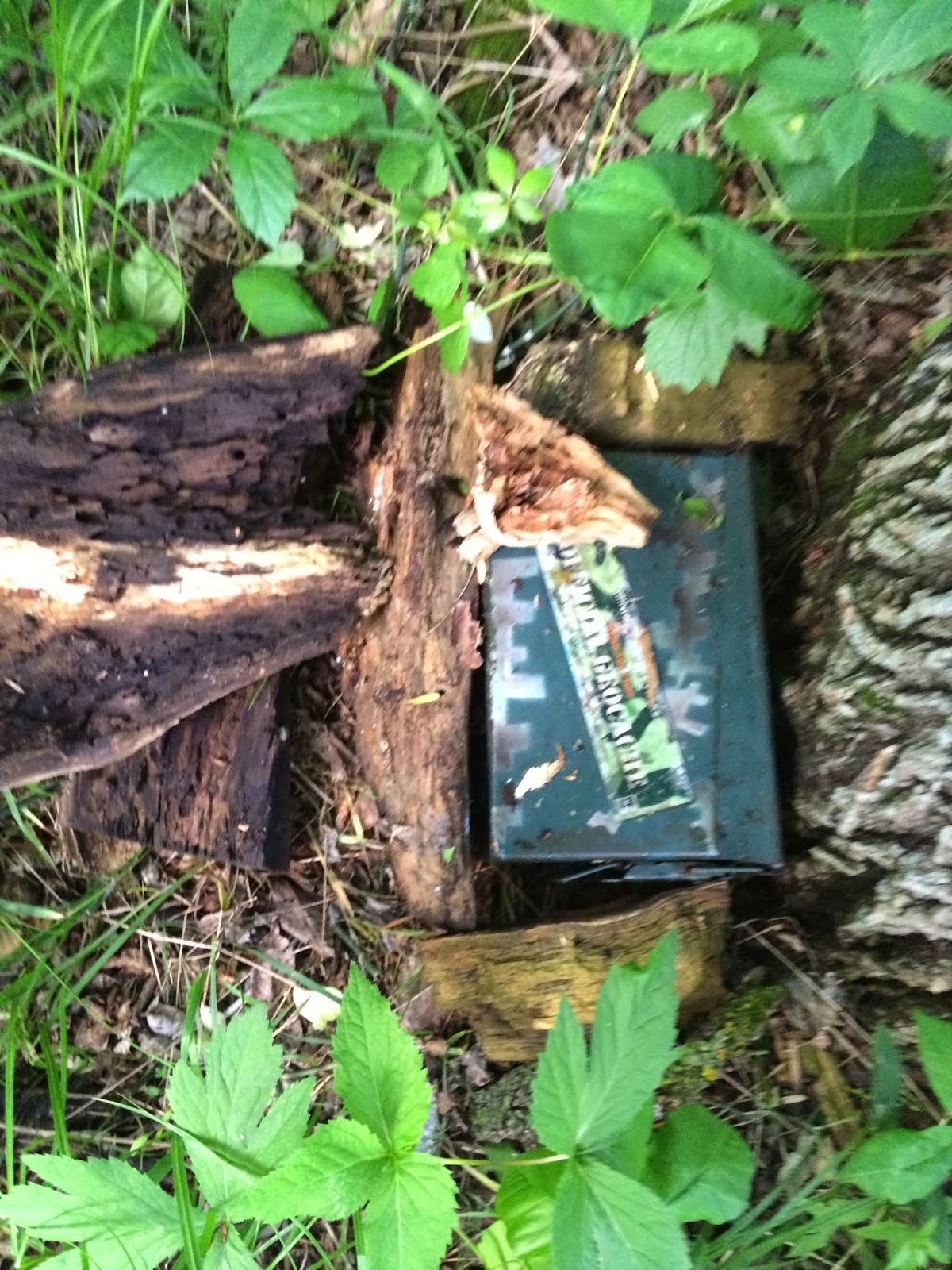
We started to hike towards the next location, and Luke looked down and saw POISON IVY everywhere alongside the trail... this means we quickly changed our game plan and Luke and Marcus went to run around and play in the "safe" part of the park and Vonnie went to finish the geocache.


Fortunately this park only had two locations so it did not take long to get to the final cache.

When I walked out of the woods I looked down and counted at least 20 mosquitoes and 2 ticks! I was only into the woods for about 15 feett and 5 minutes – CRAZY!
 |
| Historic Bridge |

Marcus and Luke had a great time while I was finishing the geocache. They explored and "played" some volleyball.


The card for this park was the American Magpie – the other state bird, the Mosquito Bird, may have been more appropriate.
 |
| Heckle and Jeckle |

Our friendly, neighborhood corvid: the magpie.

When we got back to the car we drove over to the historic site and learned a bit about the Old Mill and the flour milling process. It sure was neat.


 |
| Marcus liked the "bubbles" in the water. |
 |
| That's a lot of water out there... |
And on to the next park!
No comments:
Post a Comment