Glendalough State Park
—Battle Lake, MN—

Glendalough State Park was really close to Maplewood, only 15 miles as the crow flies; however, there were some lakes in the way, so it was closer to 35 miles by road. But after the long morning drive, it seemed incredibly fast. The drive between the parks was wonderful, filled with lakes, and trees, and rolling hills.
This is also part of the Alexandria lakes area (like Maplewood State Park and Lake Carlos State Park). To quote Wikipedia's page on Glendalough State Park: "The park has a Historic Lodge where former Presidents Dwight D. Eisenhower and Richard Nixon, and former Vice President Walter Mondale stayed when they visited Glendalough State Park."
When we got to the entrance of the park, we were welcomed by this unmanned kiosk which was really pretty and fit in perfectly with this setting. From the moment we drove in, I was enchanted by this park and it's beauty.


The initial coordinates were not at this building, but Luke jumped out and looked around for a few moments.


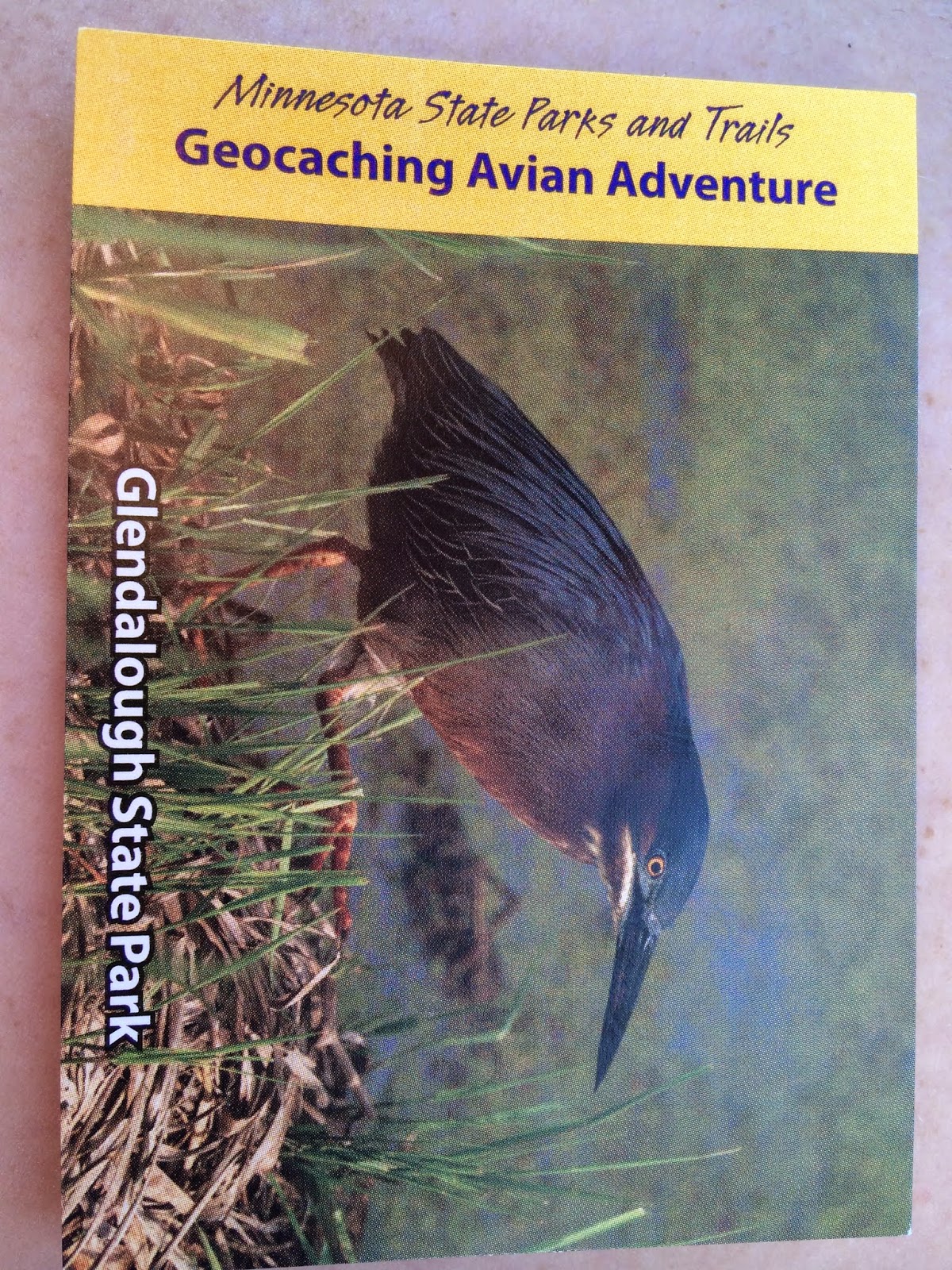
We drove through the park until we came to a parking lot – this was very close to the initial location, and it did not take us long to find it. We were in for a surprise – as you know, normally these geocache locations are pretty quick and easy to find – you find one and it directs you to the next location. The ranger at Glendalough took a completely different approach, and each of the locations contained a puzzle requiring bird identification before you could move on to the next step. WE LOVED IT! Here is the initial location and it's bird quiz. (This is probably the best geocache challenge at any of the state parks. Very, very well done indeed!! And you actually get to learn about the birds while doing it!)


 |
| A close up of the directions... |
 |
| Room to run! |

 |
| The beach – it was a pretty busy place! |
The second location was tucked into a sign right by the beach. Once again it offered a puzzle challenge. Marcus actually made the challenges a bit harder because he really liked the cards and would grab one, run away, and keep it.
 |
| Ready with GPS in hand! |


 |
| Our crack problem-solving team. |
Eventually we figured it out and moved on to the third location and a new puzzle.
 |
| Hey, Mom, look over there. |

Marcus helped me find the box in the tree.


We solved the puzzle and were off to the final location. Here are some of the views of the trail and the lake. It was picturesque and beautiful – I really want to go back and explore more.


When we got close to the geocache location we started looking... and looking...

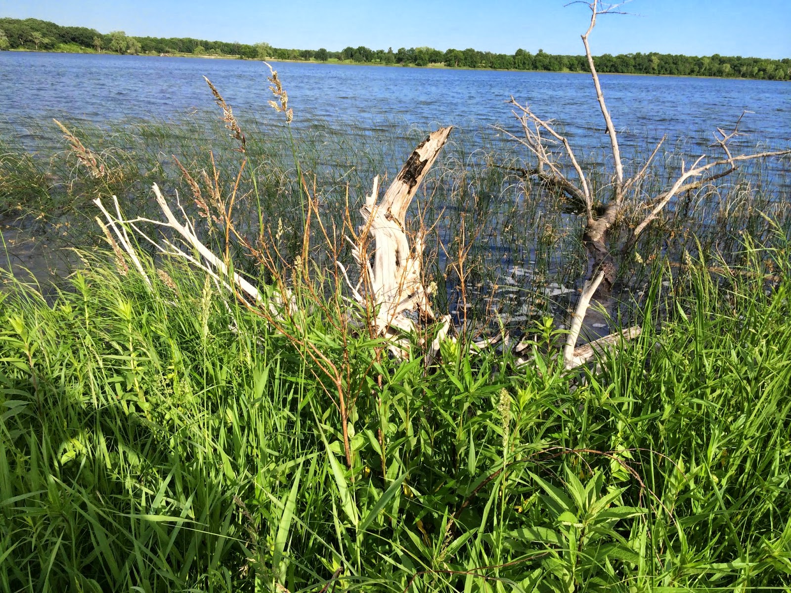
We looked in this tree stump (that is perfectly shaped to hold an ammo box)... with no luck.

We looked in the trees, under the trees, and on the trees with no luck...


We looked under the logs and around them. This was getting pretty frustrating because we were not finding anything, but it felt like the geocache should have been in the little patch of woods...

We looked on and around the dock...

Then we decided to take moment to appreciate the view!
 |
| Very clear water in Molly Stark Lake. The beach is far off in the background. |


Than we looked some more... and some more – for about 20 minutes with no luck. I tried to call the ranger station with the phone number on the website, but no one answered, and it said they were closed for the night... YIKES... So we decided to go back and see if we made a mistake on the clues.


Marcus and I went to play in the park shelter, so Luke could focus on the clues and see if we did anything incorrect. (Yes, I know they are out of order, but I really couldn't get this to fill in correctly on the picture).


The ranger gave Luke a suggestion on a closer place to park to get back there (and save the hike) and off we went. Marcus and I stayed in the car while Luke ran and found it – right where the ranger said it would be, flooded, but there anyway... (We had been getting record-setting rains this spring and early summer in 2014.)


We were at this park for a lot longer than we planned but at least we got our card!!!

Even with all the difficulty I LOVED this park and plan on going back.
Incidentally, here are before and after pictures for the state parks we have so far geocached across Minnesota (counting our next state park for the day, Lake Carlos, also).
 |
| Before this trip. |
 |
| After this trip. |
... still a ways to go!
No comments:
Post a Comment