—Franz Jevne State Park—
(Birchdale, MN)
(Minnesota's smallest state park on the Rainy River)
... Part One...

So... what do we know about Franz?
 |
| "We are here to pump you up!" Sorry, couldn't help ourselves. It's a different Franz... |
 |
| I had trouble finding an actual picture of Franz Jevne. This is seriously the closest we could get. |
After leaving Big Bog State Rec Area we drove up through what resembled Florida in terms of the look of the landscape; that is, it seemed very wet in every way. Very wet, peat bog-like, canal-ditched terrain on our way to the Canadian border at Franz Jevne. This part of the state actually is the biggest areas of peatland in the U.S. (also part of the reason why this region resisted settlement owing to its swampy terrain).
 |
| Minnesota has a lot more peat land than anyone thought. |

Once we made it through canal land and finally left Beltrami County and got away from the giant Chippewa National Forest, we entered perhaps the most remote part of the state. Oddly, Lake Bronson does not seem nearly as remote or inaccessible as the Lake of the Woods region of the state despite the former being much farther away into the northwestern corner of the state. Nor does Grand Portage seem so far away (perhaps because Duluth and the North Shore are very well-visited destinations in Minnesota already). That just makes Lake of the Woods that much cooler in our book.
Marcus was pretty content most of the way. The driving was easy. The scenery boggish and then northern woods-forested, then we hit the Rainy River—an incredibly pretty river to behold.

After turning in to Minnesota's smallest state park from Highway 11, we immediately realized it was also Minnesota's most forgotten-about state park... at least on this weekend ("It's wide open, man!"). Turns out that Franz Jevne is managed by Zippel Bay State Park 49 miles downstream. It also turned out that the park ranger (one or all—we have no idea how many there are) were not at either state park this weekend, so we were entirely on our own. No problem, we thought, let's just take care of business and enjoy this park with Marcus.
 |
| Franz Jevne does not actually have a rangers station – instead they just have a very nice kiosk. |
A quick side note whose importance will shortly become apparent: the Rainy River and Highway 11 had experienced lots of flooding this summer and this meant that Franz Jevne was off limits for geocaching earlier on (the first half of summer waterlogging most of the state). This also meant anything not secured (like a geocache box) might vanish when the water levels rose.
 |
| Canada is on the other side.... |
When we got the park we found a parking lot near the first set of coordinates and headed off on foot. It didn't take long to see the river and I was blown away by how pretty it was. As it says above this park is pretty small (only 88 acres), but the layout makes it seem a lot bigger. The entire length of the park runs along the Rainy River and the Canadian border. So... despite the fact 88 acres is not a lot of land, it seems long when it is only about 2 acres deep and 40 wide... (Acres are not a unit of length, Luke would like to point out. And he knows it, too. It actually has to do with furlongs and using oxen to plant fields back in Old England, but we digress at this point.)

During this trip it was the beginning of fall colors... So we got to a little taste of fall – you can see the turning leaves in the pictures.
We walked through the park and got to the area where the first location was supposed to be.


Marcus saw the river and the rocks on the beach and couldn't keep away from all of the fun.


 |
| I think Marcus is wearing the right footwear... |


 |
| See me searching in the background. |
 The first location was a tricky one (and a bad sign of what was to come) because the coordinates were right at the top of of the beach area... and it was woody. While the boys played and skipped rocks, I dug through the woods looking for our first clue.
 |
| Luke teaching Marcus to skip rocks... (he might need to teach me to because I don't know how). |
Finally, I found it – on this bench – about 25 ft. from where the GPS said it should be...


 |
| On the hunt. |
With the first one down we started our hike down the park to the next location. Marcus fearlessly lead the way.

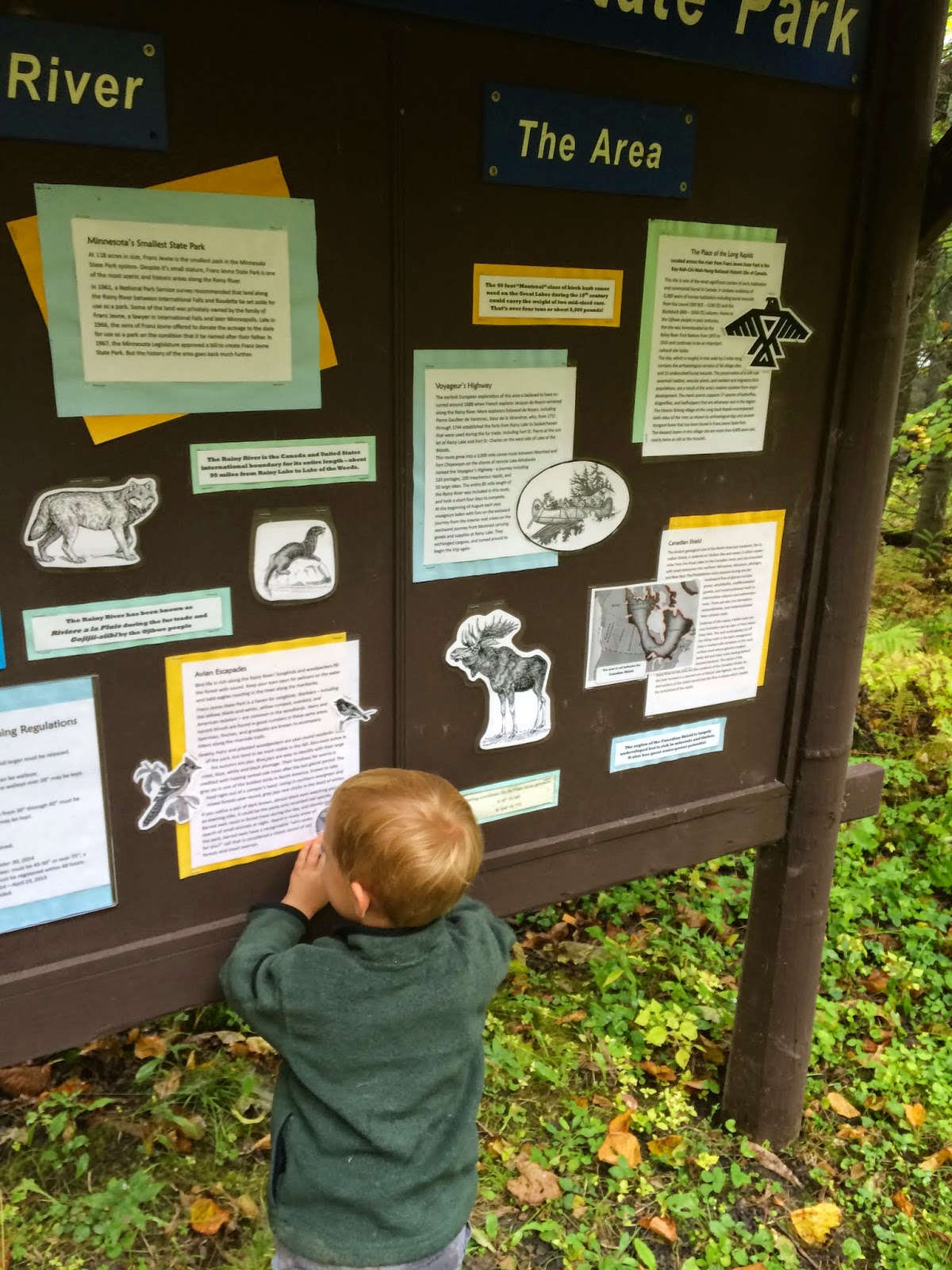
Eventually we got to a sign that gave lots of useful information about Franz Jevne State Park, but the cutest thing was how EXCITED Marcus was about all of the pictures of the animals... He told me what they all were...
 |
| "Moose!" |
 |
| "They make this harder than it should be..." |
The sign was fun but this is not where the next clue was located. So we kept walking until we got close...

Finally, when we were just a few feet away we started looking... The GPS brought us right to one of the campsites (actually right to a garbage at the campsite), and we started searching... and searching... and searching...
 |
| Standing by the garbage that the coordinates brought us to. |
We kept increasing the distance from the search, and finally we found it.
85 feet from where it was supposed to be!
This is actually the farthest distance of any of the bad coordinates we have found in any of the Avian Adventure geocaches. I read the logs at one point, and that was consensus of the other people, as well.
 |
| Old school geocaching with the trusty yellow Garmin. Can you see that some geocachers wrote some "better" coordinates on the sheet? |

 |
| Where could it be? Oh, where, oh, where? |
After competing the second stage we headed off to the next one. We took a small trail down a hill and back towards the river. We actually entered both set of coordinates into our GPSs to help in the search, but it was deja vu.

We searched high... we searched low... walked along the path... walked along the shore... looked in the woods... at some point Luke almost lost his shoe in the mud (or briefly did)... but NOTHING...

I tried to call the rangers station at Zippel Bay State Park, but no one answered (no surprise considering they never called me back from an earlier message). I looked in the logs for hints, but all they said was "interesting spot..."
 |
| No one looks happy in this picture! |
We searched for about 30 minutes before we gave up. We hoped to be able to head back here at some point in the weekend to get this geocache (not really). When we left... we were a bit annoyed, Franz Jevne was totally, like, 311 miles from, like, our house, and we needed this card to complete the avian challenge! GRRRRRR........
 |
| Pretty view but no luck! |
When we left we tried to make a quick stop at Zippel Bay to see if we could catch the park ranger, but no such luck – the ranger didn't even have a sign stating when they would be back...
We ended the day by heading to the resort we were staying at for the weekend. The best part is my parents were waiting for us and dinner was ready to eat! Marcus was so excited to see Grandpa and Grandma Z.
No comments:
Post a Comment