Split Rock Lighthouse
—Two Harbors, MN—

When you leave Goosberry Falls and head towards Split Rock Lighthouse, it is not a very far drive – just about 9 miles, and since it is all along the shoreline, the view is amazing.
If you remember back, we actually had already visited Split Rock twice this summer and attempted the Goecache once in July (the after-sunset geocaching adventure), but we were thwarted by the dark. This is why we were back here now. When we drove up, we had a chance to stop at an overpass and check out the view. This is one of the most beautiful views in the state (and the fall colors didn't hurt the view of Lake Superior either).
If you want a reminder about our last trip:
Split Rock Lighthouse in the dark....
 |
| Split Rock Lighthouse from the roadside stop just before getting there on Highway 61. |
We already had the first and second sets of coordinates from our last trip here. This meant that we skipped the first one (we drove past it), and we headed right to Number 2 (although we actually already had this one as well, but this was the starting point for the rest).
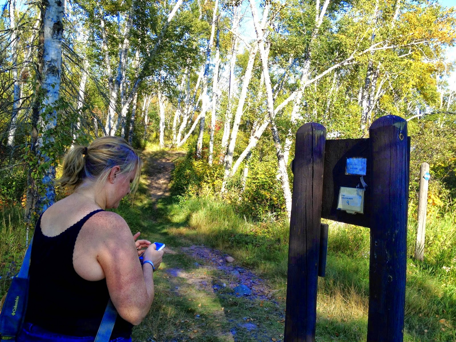
Marcus decided that he really wanted to take his blankie geocaching on this stop... had I realized how long of a hike we were about to go on, I would have worked harder at not bringing it along.
The second coordinates were listed on the board, and Luke found them last time posted there (in the dark with a few lights on at the building), but it didn't really matter because we already had the next set of coordinates.
 |
| Geocaching with a blankie... "Dad, are you sure it's this way?" |
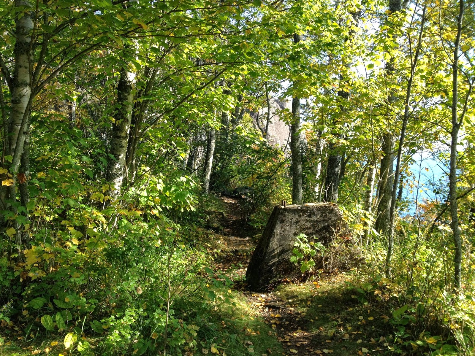
We jumped on the trail and off we went...
 |
| A Vonnie action shot. |
I don't think that Luke told me about the stairs from his last trip. It seemed quite different in full daylight. We had to head up Day Hill Trail along the way to the stairs. And there were a LOT of stairs, which, he informs me, was quiet thrilling on that inky, moonless night with the waves crashing on the water to his left and tall cliffs to his right, the night's fog broken only by the faint presence of past lighthouse keepers that were hovering right at the edge of one's conscious awareness... kinda spooky but thrilling. (We'll find out what happened to the missing coordinates from that night in this blog post soon.) There was also our old friend poison ivy on the sides of the trail, so I was being really careful while carrying Marcus.
The view from the stairs, however, was amazing...
I think Luke liked the view of his family too...
 |
| On the stairs with the small bay in the background. The hike-in camping actually seems really cool here! |
 |
| The bay again. I believe that is Corundum Point in the background. Beautiful fall day. |
We finally got to the bottom and found a trail to follow. We weren't far from the next stop at this point.
When Luke did the night-caching (we invented a new geocaching term) back in July, he made it to this stop, but never actually found it. I bet it would have been pretty spooky out here at night! The actual coordinates were not that good and there was a spur off the trail that led down to the beach at the location of the coordinates. On that side trail there was a stump with a hole in it and an empty white plastic bag. Funny enough, the bag was still there this time. Luke was racing to search everywhere last time and didn't remember to grab it in the dark while dodging poison ivy.
I spent some time in the woods looking (there was a poison ivy sighting, so Luke was hanging out with Marcus), but I couldn't find anything. Eventually, we expanded our search area and quickly found out that there was a sign about 25 feet down the trail, and that is where the next set of coordinates were. It was about 30 feet from the actual coordinates—bad coordinates make this a lot harder, especially in pitch black with only a headlamp and cell phone screen for light! Luke was under a lot of time pressure to find it last time and get back to the car so that was why he didn't go exploring farther ahead. If he had found it, he would have kept going he informs me... which would have taken quite some time...
 |
| Once again, have blankie, will geocache. |
 |
| Found 'em on the back of the sign. |
From here it was a HIKE to the next stop. For some reason we don't have any pictures, but it was a trail and nothing much that was too special about it – other than it was a real hike. A bit up the path we found another sign that had the next set of coordinates... and a clue on them.
We crossed over a bridge and found our way... we were now getting close to the end! I don't know why, but we don't have a ton of good pictures of this journey.
We got close to the spot and looked in the woods. Their was a big pile of stuff...
Including some old pipes. And right in the middle was our cache.
 |
| Marcus looks so serious in this photo. Just another notch in his belt. |
We actually ran into another geocaching couple and had a chance to share stories... he had accidentally stolen the pen and was bringing it back to the ammo box. It is fun to visit with other geocachers.
From here we headed back... but we were a bit too gabby with the other geocachers, which resulted in missing our turn off the high trail we decided to take back, and we ended up hiking a bit longer than we planned on – good thing I changed shoes from the last park. I also managed to hide the blankie in the diaper bag, so it would last the whole weekend without getting too dirty. The trail back was really nice...


No comments:
Post a Comment