Lake Vermillion State Park
—Soudan, MN—
 |
| Picture from LakeVermilionResorts.com. We didn't actually see this sign on our geocaching. |
Lake Vermillion State Park is the newest Minnesota State Park; the land was actually only recently transferred to the Minnesota DNR in 2010. Thus far it is pretty undeveloped. Here is what the DNR has to say about it: "Minnesota's newest state park is under development, and public access and recreation opportunities are currently very limited.
The park will eventually be home to unique camping opportunities,
including camper cabins, boat-in campsites, traditional camping, and
group camping. There will be a wide range of interpretive programs
offered throughout the year. Hiking trails and boardwalks will provide
fantastic vistas along the lake and to inland areas, and there will be a
fun outdoor adventure area designed for people of all ages."
 |
| GPS view of the two locations. |
On the screenshot here, you can see how close the two caches were to each other.
We all started walking down a big trail... It was actually a mixed-use trail that could be used for ATVs and snowmobiles. It actually looked like it was big enough for a car to drive down it if one wanted to...
 We hiked our way down the trail and had two concerns to be aware of at all times: 1) we were on the lookout for the emerald itcher, a.k.a. Poison Ivy (which we did see), and 2) we had to keep our eye on the time – we could not be late to the mine tour, or we would miss it. When we made it to the first stage it was about 11:10 AM, so we had 50 minutes before the tour was scheduled to start. When we got to the first location, it took a few minutes to find. You can see it in the picture below. It looks like the container had been zip-tied to a tree at some point but was not broken. This made it a bit harder to find. There was also some poison ivy that we needed to contend with, so we were on high vigilance.


The clock was still ticking till the tour, and it was 0.3 miles to the next stop... Marcus was not moving very quickly, so we made the decision that I would go on ahead, and Luke and Marcus would go back to the car and up to the mine to play on the old mining equipment until the tour started. I was responsible for forging ahead and finishing this park's geocache and making it back before the tour started... YIKES! I just wish I was wearing better running shoes...
 |
| Silly Vonnie. |
 The trail actually got a bit more difficult as I went along, but I quickly made it to the second stop. This time the zip tie was still in place, and the clue was hanging right on the tree.
  |
| Look closely. Can you see it attached to the tree? |


We have had time pressure before, but I have never been so acutely aware of the clock ticking away as I was on this geocache adventure. So the second stage was done. I loaded the coordinates and headed towards the next location... it was another 0.3 miles... I was doing the math at this point and making sure I would have enough time to get back to the mine for the tour, and I was guessing it was about 3/4 of a mile back to mine at this point.

I kept running—okay, my run is so slow it probably can't be considered a real run—and I made it to the 3rd stage. Everything was in order and easy to find for number three. Now off to the final coordinates.
 |
| Can you see the path leading up to the next stop? (Notice there are already lots of leaves on the ground this far north.) |


Even though I was moving quickly, I did take a few seconds to breathe and enjoy the silent majesty of the northern woods. It was really quiet out here, and there was not a lot of company (I only saw one other hiker). It was all in all a beautiful fall day!


I made it to the end just in time. The clock said I had 20 minutes to make it back, and I can admit that I am not the fastest. I grabbed the card, put the ammo can away, and started to run back.
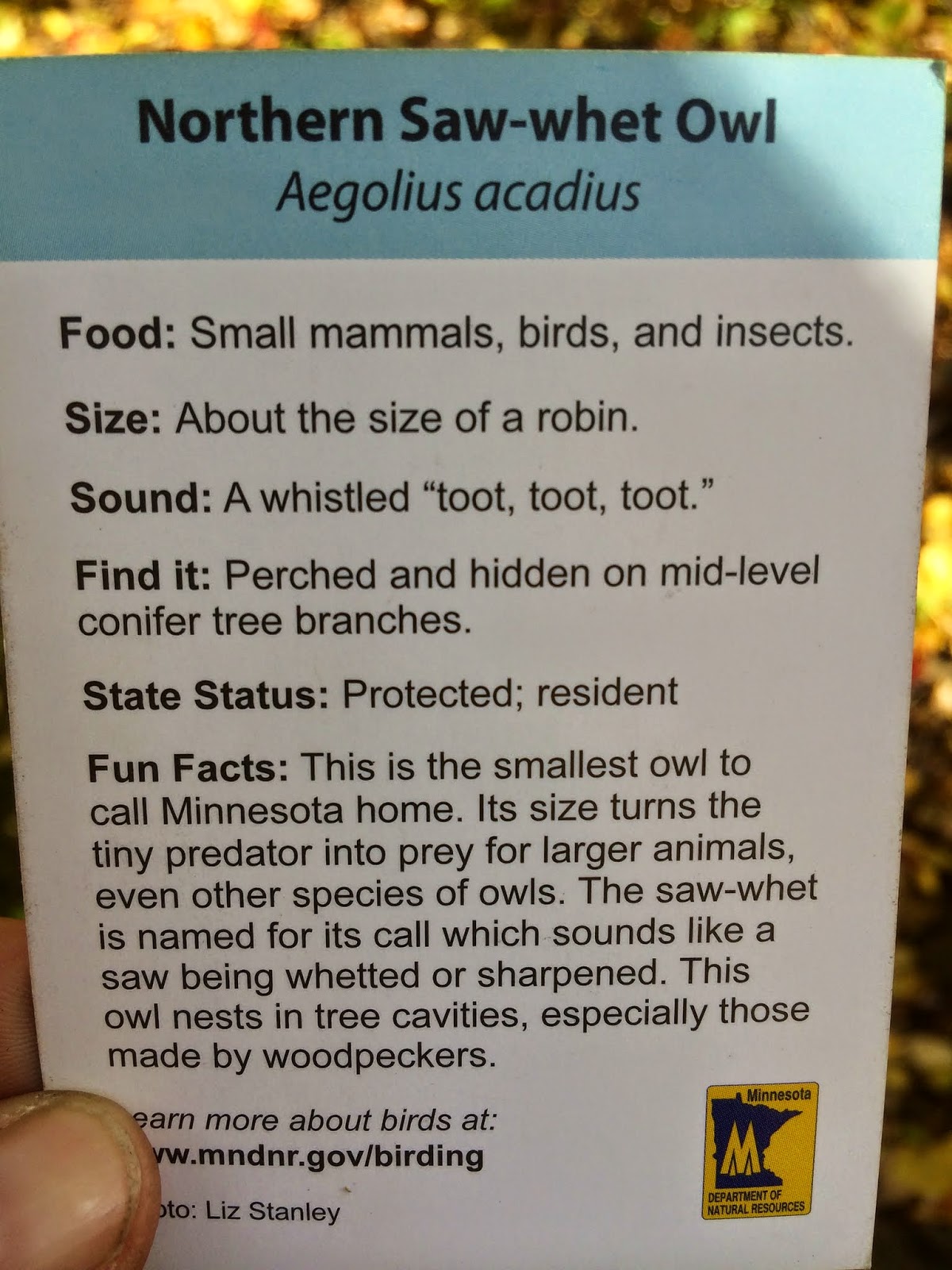
 |
| Another owl card. We like these! |
 |
 |
| Here is a pictures of the park map. Ignore my reflection. |
I ran and ran and ran... Fortunately, this story has a happy ending... I made it back with about five minutes to spare... But I was pretty winded and hot... Good thing we were headed underground to go on a nice cool mine tour next!
No comments:
Post a Comment