Wednesday, October 22, 2014

Lake Vermillion State Park

Lake Vermillion State Park

—Soudan, MN—

Picture from LakeVermilionResorts.com.  We didn't actually see this sign on our geocaching.
Lake Vermillion State Park is the newest Minnesota State Park; the land was actually only recently transferred to the Minnesota DNR in 2010.  Thus far it is pretty undeveloped.  Here is what the DNR has to say about it: "Minnesota's newest state park is under development, and public access and recreation opportunities are currently very limited. The park will eventually be home to unique camping opportunities, including camper cabins, boat-in campsites, traditional camping, and group camping. There will be a wide range of interpretive programs offered throughout the year. Hiking trails and boardwalks will provide fantastic vistas along the lake and to inland areas, and there will be a fun outdoor adventure area designed for people of all ages."

GPS view of the two locations.
 One interesting thing about this park is that it is right next to the Soudan Mine State Park and basically attached if you walk through  the back parking lot area past the Soudan mine buildings.  This new park will be managed by the rangers at the Soudan Mine.  I actually struggled with where to post this blog on a timeline basis.  We actually went to Soudan Mine first, but just to buy tickets for the noontime high-energy physics laboratory tour (we didn't want to miss that!).  Since we have about 1.5 hours before it started, we decided to try to knockout a geocache before the tour.  We started walking down the road toward the starting points of both geocaches (they were only about two blocks apart) and came to the path that led to Lake Vermillion geocache first.

On the screenshot here, you can see how close the two caches were to each other.

We all started walking down a big trail... It was actually a mixed-use trail that could be used for ATVs and snowmobiles.  It actually looked like it was big enough for a car to drive down it if one wanted to...

We hiked our way down the trail and had two concerns to be aware of at all times: 1) we were on the lookout for the emerald itcher, a.k.a. Poison Ivy (which we did see), and 2) we had to keep our eye on the time – we could not be late to the mine tour, or we would miss it.  When we made it to the first stage it was about 11:10 AM, so we had 50 minutes before the tour was scheduled to start.  When we got to the first location, it took a few minutes to find.  You can see it in the picture below.  It looks like the container had been zip-tied to a tree at some point but was not broken.  This made it a bit harder to find.  There was also some poison ivy that we needed to contend with, so we were on high vigilance.


The clock was still ticking till the tour, and it was 0.3 miles to the next stop... Marcus was not moving very quickly, so we made the decision that I would go on ahead, and Luke and Marcus would go back to the car and up to the mine to play on the old mining equipment until the tour started.  I was responsible for forging ahead and finishing this park's geocache and making it back before the tour started... YIKES!  I just wish I was wearing better running shoes...
Silly Vonnie.
The trail actually got a bit more difficult as I went along, but I quickly made it to the second stop.  This time the zip tie was still in place, and the clue was hanging right on the tree. 

Look closely.  Can you see it attached to the tree?


We have had time pressure before, but I have never been so acutely aware of the clock ticking away as I was on this geocache adventure.  So the second stage was done.  I loaded the coordinates and headed towards the next location... it was another 0.3 miles... I was doing the math at this point and making sure I would have enough time to get back to the mine for the tour, and I was guessing it was about 3/4 of a mile back to mine at this point.

I kept running—okay, my run is so slow it probably can't be considered a real run—and I made it to the 3rd stage.  Everything was in order and easy to find for number three.  Now off to the final coordinates.
Can you see the path leading up to the next stop?  (Notice there are already lots of leaves on the ground this far north.) 


Even though I was moving quickly, I did take a few seconds to breathe and enjoy the silent majesty of the northern woods.  It was really quiet out here, and there was not a lot of company (I only saw one other hiker).  It was all in all a beautiful fall day!


I made it to the end just in time.  The clock said I had 20 minutes to make it back, and I can admit that I am not the fastest.  I grabbed the card, put the ammo can away, and started to run back.

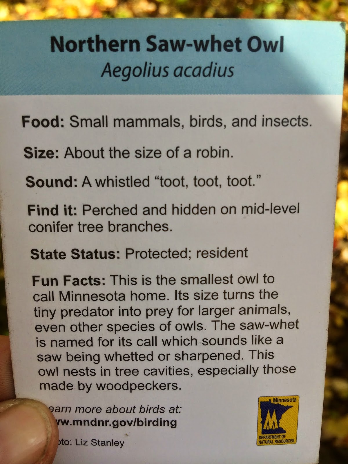
Another owl card.  We like these!


Here is a pictures of the park map.  Ignore my reflection.
I ran and ran and ran... Fortunately, this story has a happy ending... I made it back with about five minutes to spare... But I was pretty winded and hot... Good thing we were headed underground to go on a nice cool mine tour next!

Tuesday, October 21, 2014

Bear Head Lake State Park

Bear Head Lake State Park

—Ely, MN—


Fall colors on the drive.
We got up early the next morning for a long day of adventuring.  We had five parks to visit and some activities to fit in, and we were excited to go.  The drive was really pretty—the colors in this part of the state were pretty close to peak, so it just made every thing even more awesome.

The first park we visited was Bear Head Lake State Park.  The main features of this park are its lakes.  This is how the Minnesota DNR describes it: "Secluded in the Northwoods, this park contains pristine lakes; it is home to black bears, nesting eagles, wolves and moose. Stands of white and red pine trees tower over the birch, aspen and fir trees. Located just south of the Boundary Waters Canoe Area, the park shares a similar wilderness quality. Explore miles of shoreline by canoe. Swim at the beach, picnic in the shelter building, or fish for walleye, bass, crappies or trout. Trails in the park link-up with the Taconite State Trail and offer snowmobilers, skiers and hikers plenty to enjoy".   

To Luke and I, it felt just like being the in the Boundary Water Canoe Area Wilderness (BWCAW) without actually being in the BWCAW (this state park is only about 15 miles south of Ely and 30 miles south of the BWCAW, but it completely feels like you are in the BWCAW... except with roads and motor vehicles).  The park was beautiful, and it is really popular.  An interesting piece of trivia: Bear Head Lake State Park had actually won the 2010 title of "America's Favorite Park" in a nationwide campaign sponsored by Coca-Cola.
The entrance to Bear Head.

When we got to the park, Luke got out and explored the Visitor Center while I figured out where the first clue was going to bring us (it was only about 300 feet from the visitor center).

When Luke got back, I ran over and found the first set of coordinates.  I had actually read the logs and already knew that they suggested driving to find the second spot and hiking from there.  We always try to take the best advice, and that was our plan.


I was surprised at how busy the park was.  When we went on the Lake of the Woods trip, the parks were dead, and it just seemed like everything was over for the summer.  This trip was completely different: the parks were busy, and there were lots of people out, and ALL of the rangers stations were actually manned!  I liked this a lot more.

The first set of coordinates brought us right to the trailhead for the Norberg Lake Trail.  The clue was right on the back of the sign (very common... which is how it was tricky with how the ranger at William O'Brien State Park placed it in a hide-a-rock under the sign!).


It wasn't that far to the next stop down the trail (0.3 miles, so about 6 minutes easy walking), but following other's advice, we decided to head back to the car and find the next parking lot to stop in.


We jumped back into the car headed off.  The funny thing about this trip is that the road we took went around the park and pretty much out of the way.  I kept looking at the GPS while we drove, and we got farther and farther away from the second stage until we finally got there – then it was still 0.2 miles to the next location!  We ended up in a parking lot that was next to a really cute building and near to the eponymous "Bear Head Lake."


We quickly found a trailhead that lead to the  same trail that we saw from the other side.  This was the Norberg Lake Trail – it was also the Minnesota DNR Hiking Club Trail.  We got out of the car and got ready to start hiking it.  The weather was amazing, and it was an almost perfect day.


Another gratuitous selfie... but I just liked this picture!
This was a really nice and wide trail... we didn't see any of the green menace (poison ivy), which is a really good thing whenever it is not around.  We made our way up the trail... Marcus is a hoot.  One moment he is walking, next he will run ahead, and then he turns around right in front of one of us and stops—this is his cue for one of us to pick him up—then he says, "Out!" and it is time to walk again... then he changes parents... this all happens in roughly 50 steps!  It is awfully cute!


We hiked a ways down the trail and got close to the next location.  This was a really odd setup.  The box for the first clue was just sitting on the ground in a wooden box.  I think that it could easily get misplaced just sitting out in the open like that.


Once we added the next set of coordinates, we could see that it was bringing us back towards the parking lot and then even a bit farther than that.


We stopped for a moment by the building... It was really pretty.  Marcus LOVED the water fountain.  I bring him to the great outdoors, and all he wants to do is play with the water fountain...


Now we were off to find the next location, so we headed towards the lake. 


A bit about the geology in this part of the state, which sits on the very ancient Canadian Shield like most of northeastern Minnesota does:
"Volcanoes and ancient seas produced the bedrock of the Bear Head Lake area. The bedrock of Ely greenstone and giants-range granite was scoured and gouged by glaciers. Eagles Nest and Bear Head Lakes, along with the park's rolling hills, were formed from the glacial action. Along the lakes and road cuts, visitors can see many different shapes and sizes of rock left by the glaciers." —Minnesota DNR

We kept walking toward the final destination, and the compass kept pointing right toward that tree stump.

The final cache was "hiding" in the stump... (Just a quick Marcus fact: right now, according to him, everything is "hiding" all of the time as he says!)


Some good low-angle stuff here.


Marcus and his prize.

This bird was the purple finch.  A very cool-looking bird!

We still had some time to play before heading out to see Soudan Mine, so we hung around for a bit and checked out the lake.


Marcus picked up the branch and kept sweeping the dirt with it.


When we were done checking out the lake, we went back and explored the building.  I think it is the coolest state park building we have seen.


A few last views from Bear Head Lake State Park...


Like being in the Boundary Waters!

Mommy and Marcus.
Daddy playing in the leaves.  Marcus loves this!

Search This Blog